

Up to the minute
Weather today
Temperature
-2 °C / 7 °C
Sunshine hours
7 h


Forecast
Weather forecast
DAILY WEATHER IN DETAIL
THE WEATHER TODAY
A significant cold front arriving by midweek will bring a lasting change in the weather. Spring will retreat far into the Mediterranean region, while late winter will make its presence felt once again with full force, even down into the low-lying valleys. There will be little sign of this yet on Wednesday morning; only the westerly wind in the mountains will pick up. However, there will be bright sunshine and mild temperatures until past noon. Clouds will quickly roll in from the west over the afternoon, and the front will reach us in the late afternoon. This will bring heavy precipitation, with the snow line dropping rapidly below 1000 meters above sea level. During the night into Thursday and on Thursday itself, snow will continue, at times heavily, amid heavy cloud cover. The snowfall will not subside until Friday morning, when the skies will begin to clear. The night into Saturday could be clearer, bringing very severe frost by Saturday morning. Saturday itself promises plenty of sunshine. More clouds will move in on Sunday, and it will remain cold, typical of late winter.
Wetterstationen
LIVE REPORT
CURRENT TEMPERATUREs
ALL WEATHER STATIONS IN ISCHGL
table.scrollable
Avalanche warning
2 Moderate
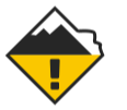
The avalanche warning level refers to the Austrian part of the ski area
Avalanche warning
2 Moderate
The avalanche warning level refers to the Swiss part of the ski area
Up to the minute
The weather in Ischgl
Real-time information from your holiday region
Sunscreen, windbreaker or umbrella? To come perfectly prepared for your holiday adventure in the Paznaun valley, it’s a good idea to have a look at the weather forecast. Weather you’re headed for a ski resort or the region’s hiking trails – we have all the information you need for your upcoming trip.
Our forecasts keep you informed on things like the snow line, sunshine hours, rain probability and the daily maximum and minimum temperature. Plus, we’ll keep you up to date on the average wind speed and the current avalanche warning level.
Stay Tuned & Stay involved
What inspires – and what matters


