
Description
02
Intro
Easy winter hike in Ischgl
Description
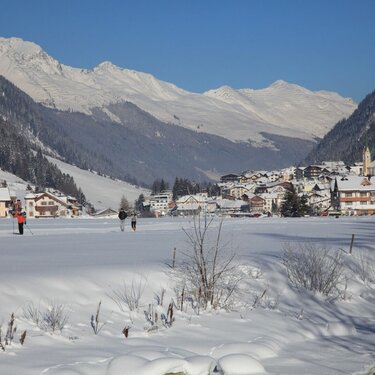
The Ischgl winter hiking trail is perfect as an initial explorative tour or something for more leisurely days when on winter holidays. With 5 km of level routing, it is not overly demanding yet leaves you with the feeling of actually having done something. The hiking trail starts right by the Silvretta parking lot and is marked with a sign (entry point to cross-country skiing trail). In the beginning, a short walk leads directly along the cross-country skiing trail before the route branches off onto a separate trail in the hamlet of Paznaun. The trail continues across level terrain for 2,5 km in direction of Mathon.
Having arrived at the recycling yard, the following options are available: either take the same trail back (total length of hike 5 km) or continue hiking towards Galtür, where you can get on the Mathon winter hiking trail.
Arrival
The autoroute (A12 (westbound) or A14 (eastbound)) leads you to the Arlbergschnellstraße (S 16). At the exit for Pians, turn onto the Paznauntalstraße (B 188) and follow its course into the Paznaun.
Parking
Ischgl Silvretta parking lot
Public transport
With the railway station in Landeck, the Paznaun is optimally connected to the Austrian train network. From Landeck-Zams station, only a short bus ride separates you from the Paznaun. Every half hour, line bus 260 runs from there through the valley. Bus stop: Silvrettabahn


