
Description
02
Intro
Ischgl - Galtür, 16.00 km, 1800 m, 7.50 h
Description
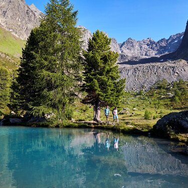
We begin at the parish church in Ischgl and hike from there to the intermediate station. We soon adventurously cross the Fimbabach on the lower Kitzloch suspension bridge and then get to the foot path, following the signposts for Rauher Kopf. However, before we reach the Rauher Kopf, we have to tackle a challenging steep section through the forest, then cross the Silvretta cable car area, before reaching the Jagdhütte on Tschamatschkopf after around 1.5 hours. After another hour we finally reach the Rauher Kopf at 2478m. When the weather is great on Ischgls local mountain you can see right into the distance from Bielerhöhe to Imst. After a stop for a breather on the summit we follow the signposted route into the valley along the ridge; we soon leave this route and climb to Außerbergli at 2080m. After another hour we get to the Innerbergli at 2066 m. Please note this tip from those in the know: You can take a detour from Innerbergli to Bergli-See, which will take a comfortable 15 minutes or so. This little mountain lake idyllically nestles in a fascinating rocky backdrop and is deep blue in colour; you can see the reflection of the surrounding mountains in it. From Innerbergli we continue climbing and in around an hour we get to Larein Alpe at some 1860m. This Alpine inn is open for business and the cheese is worthy of a medal. (Open from mid-June mid/end September). From Larein Alpe it takes around half an hour to get to the Stafalipond with a barbecue area and that brings us to the end of the Galtür High Route. After this spectacular day we dive back into civilisation in Galtür. We now have almost half of the High Route Paznaun behind us and we have so many memories already. Since the next section is somewhat more leisurely, we might start the next stage with a trip to the Alpinarium or relax and unwind a bit in the leisure centre.
Difficulty: Difficult Length: 16.00 km Duration: 7.50 h Ascent: 1800 m Descent: 1600 m Highest Point: 2459 m Lowest Point: 1116 m Start: Ischgl End: Galtür Height valley: 1363 Height mountain: 2459
Tour type


