
Description
02
Intro
Galtür - Friedrichshafener Hütte, 7.00 km, 850 m, 3.50 h
Description
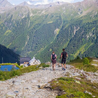
Today we take things a bit easier and the most leisurely stage awaits us, with 3.5 hours walking time. Nonetheless, there is still 850 metres altitude to negotiate before we reach our destination for today: Friedrichshafener Hütte. From the centre of the village we head to the district of Außertschafein at 1560m and from here we follow the signposts for Friedrichshafener Hütte. This route is really quite challenging from the Tyrol Flood and Avalanche Protection Services office (Amt der Tiroler Wildbach- und Lawinenverbauung). Information boards have been put up at two sites, providing details about the vegetation, forestry and also the installation of avalanche barriers. From this section we are in the Verwall group and inevitably we start to gaze in wonder at the side of valley opposite, which is located in the Samnaun group, where we were a few days ago. Upon reaching the footpath we enjoy a relaxing hike to Friedrichshafener Hütte which is situated at 2138m. The sun shines for a long time in the evening on the routes we have already walked on - Rauher Kopf, Außerbergli, Innerbergli and the rest.
Difficulty: Middle Length: 7.00 km Duration: 3.50 h Ascent: 850 m Descent: 250 m Highest Point: 2329 m Lowest Point: 1547 m Start: Galtür End: Friedrichshafener Hütte Height valley: 1560 Height mountain: 2138
Tour type


