
Description
02
Intro
A short and simple circuit to the idyllic Zeinissee lake in neighbouring Vorarlberg.
Description
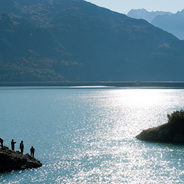
From the start point in the centre, the route runs north and crosses the Vermuntbach river behind the last houses (merging with the Jambach 100 m further down the valley to become the Trisanna river) and then heads into the valley towards the Zeinisjoch. The route runs along asphalt and gravel sections and after 4.5 km, reaches the 1,842 m pass which also forms the border between the states of Tyrol and Vorarlberg. From here, it follows gravel paths down to the lake where a guesthouse and campsite are situated. On the other side of the lake, the route follows an asphalt road back to the Zeinisjoch and then on the same route back to Galtür. Tip Bike & Run: an additional sprint around the Kopsstausee lake is the perfect end to an unforgettable day of sport and nature!
Arrival
The autoroute (A12 (westbound) or A14 (eastbound)) leads you to the Arlbergschnellstraße (S 16). At the exit for Pians, turn onto the Paznauntalstraße (B 188) and follow its course into the Paznaun.
Parking
At the Arzthaus Galtür or at the Sports and cultural centre Galtür
Public transport
With the railway station in Landeck, the Paznaun is optimally connected to the Austrian train network. From Landeck-Zams station, only a short bus ride separates you from the Paznaun. Every half hour, line bus 260 runs from there through the valley. Bus stop: Galtür Dorfplatz
Tour type


