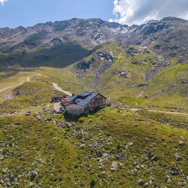

Description
02
Intro
See - Pfarrkirche - Ascherhütte, 12.50 km, 1480 m, 5.50 h
Description
We start in See near the parish church at 1050m and follow the tarmac road to the easterly hamlet of Oberfrödenegg at 1270m, which we will get to in around 35 minutes. We continue without much ado, following the steep track through the so-called Giggler Tobel, where at around 1809 the battle of the Giggler Tobel took place. We continue past the abandoned snack station Almstüberl to the fork in the route in Giggl. Keeping to the signs for Ascherhütte, we descend briefly and again reach a fork in the route. Take the upper route until, at the small chapel, the actual altitude trail begins. From here, in some 40 minutes we reach the romantic Giggler Alm at 1845m which unfortunately is abandoned but is still in a wonderful setting. From the Giggler Alm hike towards the valley through romantic larch forests, cross the Gigglbach; there is then quite a steep section to tackle before we reach a dreamy spot, which is unsurpassed. From barely any other place can the entire Unterpaznaun region be better seen than here. Spending a little bit of time here and enjoying the mountainscape is almost obligatory. From here we reach our first destination in around 1 ¼ hours, Ascherhütte at 2256m, the route is pleasant and made easier via the signposted steep track.
Difficulty: Middle Length: 12.50 km Duration: 5.50 h Ascent: 1480 m Descent: 270 m Highest Point: 2256 m Lowest Point: 1042 m Start: See - Pfarrkirche End: Ascherhütte Height valley: 1050 Height mountain: 2256
Tour type


